Drslavice
Digital Passport
Nomenclature and Geography
Category: City / Municipality
Summary
About the place: Drslavice is a municipality in the Uherské Hradiště District of the Zlín Region in south-eastern Moravia, situated along the Olšava river valley within the Moravian Slovakia (Slovácko) cultural region. It lies at the foot of the Vizovice Highlands roughly 5 km west of Uherský Brod.
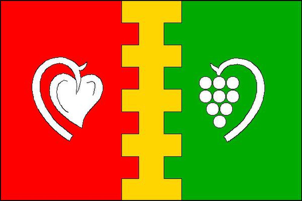
Flag Description: The flag consists of three vertical stripes of red, doubly embattled (dancetty/toothed on both sides) yellow, and green in a 2 : 1 : 2 width ratio. The central yellow stripe has five rectangular teeth and four indentations. The red stripe bears a white water lily leaf (trefoil pad), and the green stripe bears a white bunch of grapes on a stalk, both oriented towards the centre. The width-to-length ratio of the flag is 2 : 3.
Symbolism: The municipal symbols were granted on 27 June 2001 (Decision No. 87 of the Chairman of the Chamber of Deputies of the Parliament of the Czech Republic). The yellow embattled/toothed stripe (echoing the crenellated tower in the coat of arms) recalls the Lords of Cimburk, who united the village with the Uherský Brod estate (bearing an embattled crest), as well as local historical fortifications. The white water lily pad in red derives from the coat of arms of the Counts of Kaunitz, longtime holders of the Uherský Brod dominion. The bunch of grapes against green represents the local winemaking tradition and the agricultural fertility of the Slovácko region.
Statistics
Area
7.89 km²
Population
501