Dubnice
Digital Passport
Nomenclature and Geography
Category: City / Municipality
Summary
About the place: Dubnice is a rural municipality in Česká Lípa District, Liberec Region, situated along the Dubnický brook between Stráž pod Ralskem and Jablonné v Podještědí in the Ralsko Uplands.
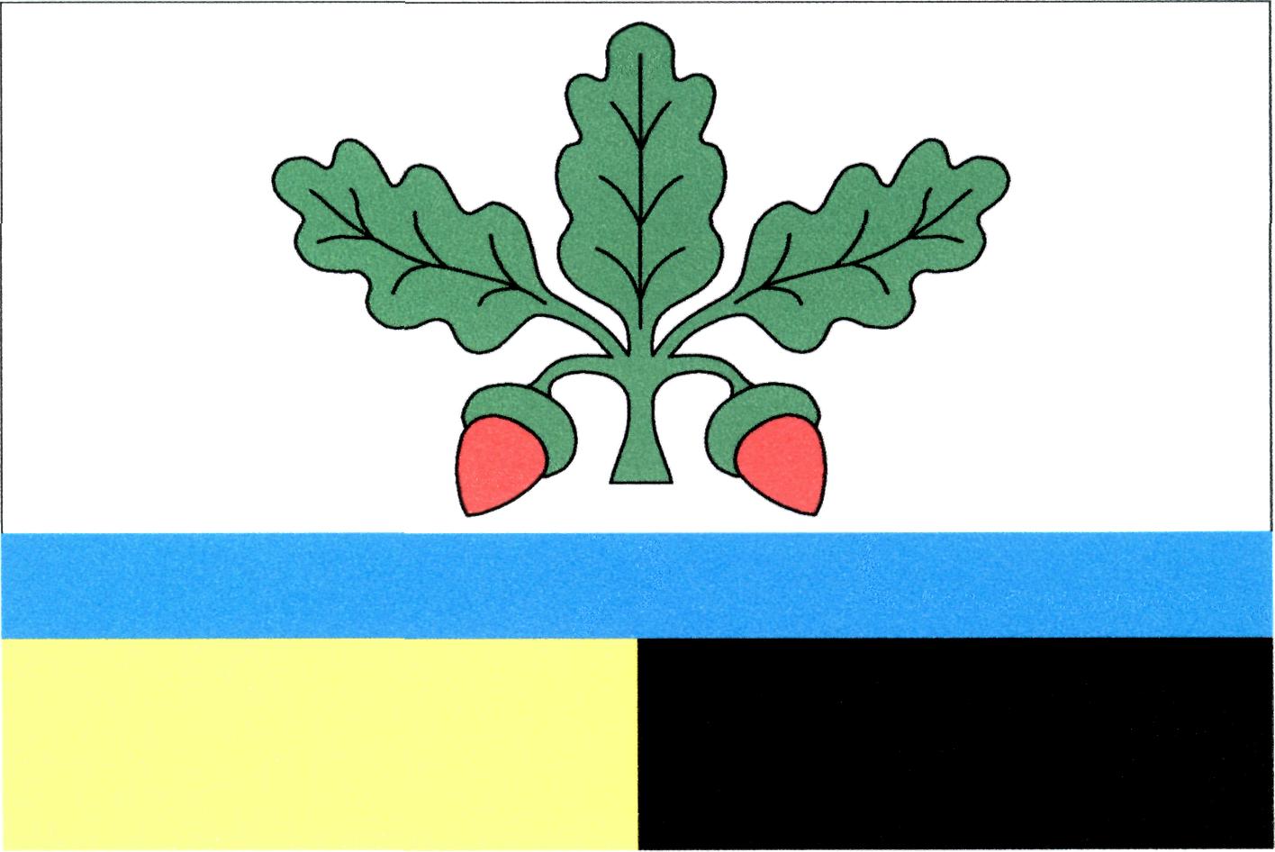
Flag Description: The flag consists of three horizontal stripes: white, blue, and parted per pale yellow and black, in a width ratio of 5 : 1 : 2. Centered in the white stripe is a green oak trefoil leaf flanked by two pendent red acorns. The ratio of the flag's width to length is 2 : 3.
Symbolism: The green oak leaf with acorns serves as canting arms/symbolism referencing the village's name (derived from the Czech word for oak, 'dub'). The narrow blue stripe symbolizes the Dubnický brook flowing through the village. The bottom stripe parted per pale yellow and black is derived from the coat of arms of the Lords of Wartenberg (Vartenberk), historical founders and lords of the estate.
Statistics
Area
15.83 km²
Population
640