Dvory
Digital Passport
Nomenclature and Geography
Category: City / Municipality
Summary
About the place: Dvory is a municipality in the Central Bohemian Region (Nymburk District), situated in the fertile lowlands of the Polabí region approximately 4 km north of Nymburk. It comprises three administrative parts: Dvory, Veleliby, and Zdonín.
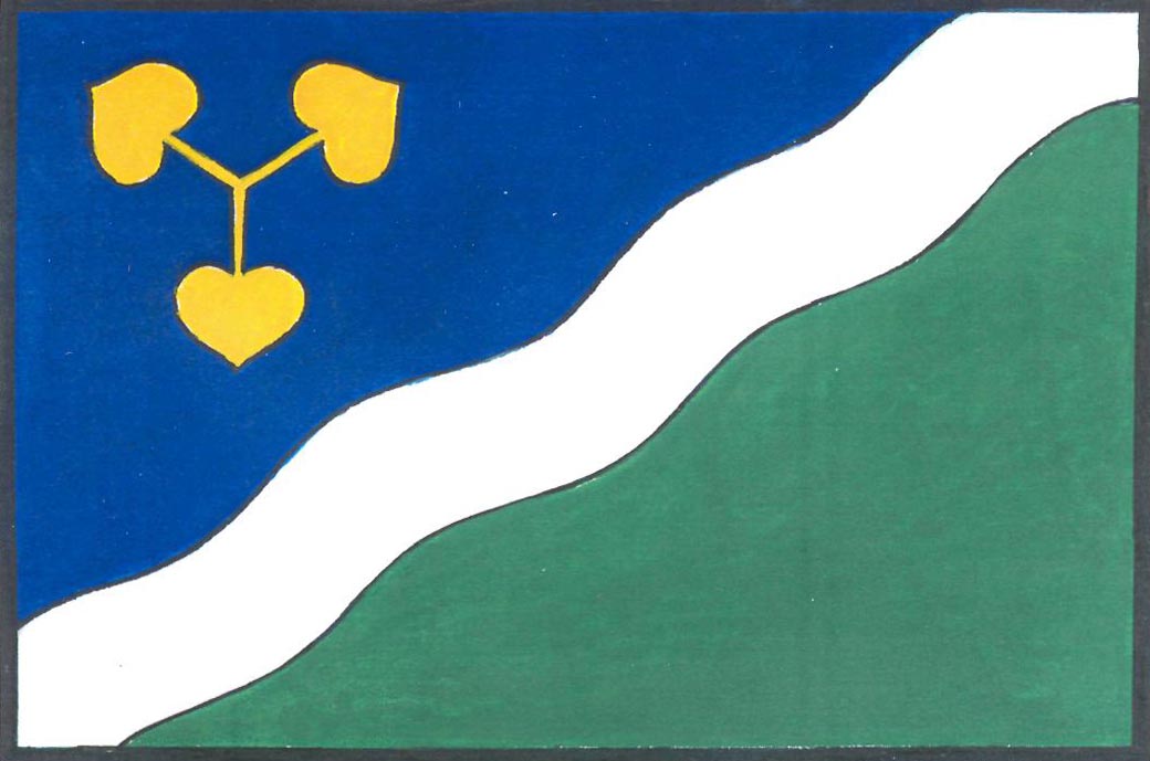
Flag Description: A flag divided by a bendwise white wavy stripe, one fifth of the width of the hoist, into a hoist-side blue field and a fly-side green field. In the upper hoist corner is a yellow lime-tree trefoil. The ratio of hoist to fly is 2:3.
Symbolism: The white wavy stripe symbolizes the local Liduška brook traversing the municipal territory. The golden linden trefoil represents both the Czech national tree and the union of the municipality's three parts (Dvory, Veleliby, Zdonín). The green field signifies agriculture and the fertile landscape of the Polabí basin, while blue reflects the water motif.
Statistics
Area
6.79 km²
Population
619