Ennepetal
Digital Passport
Nomenclature and Geography
Category: City / Municipality
Summary
About the place: Ennepetal is a town in the Ennepe-Ruhr district in North Rhine-Westphalia, Germany. Located on the southern edge of the Ruhr area in the hilly Sauerland region, it is named after the Ennepe River which flows through the municipality.
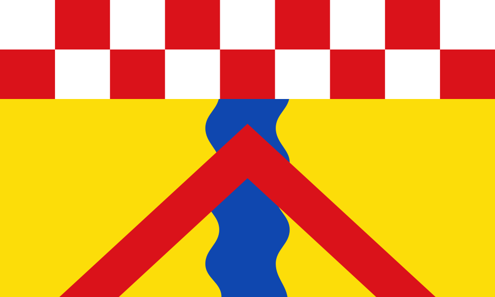
Flag Description: The flag field consists of a yellow field divided in the middle by a vertical blue wavy stripe and covered by a red chevron rising from the bottom edge above the center of the flag. In the chief (top portion), there is a checkered fess consisting of nine squares in two rows in an alternating color sequence of white and red. The ratio of the widths of the yellow sections and the blue wavy stripe is 56:23:56.
Symbolism: The elements on the flag are derived from the city arms granted in 1953. The checkered fess in white and red represents the historical connection to the County of Mark. The blue wavy stripe symbolizes the Ennepe River flowing through the town's valley. The red chevron refers to the fortifications, Burg Altena, or structural history linked to the region's heritage.
Statistics
Area
57.43 km²
Population
30,652