Entre Rios do Oeste
Digital Passport
Nomenclature and Geography
Category: City / Municipality
Summary
About the place: Entre Rios do Oeste is a municipality located in the western part of the state of Paraná, Brazil, near the Itaipu Reservoir.
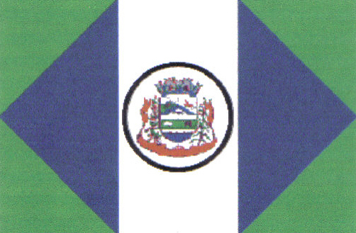
Flag Description: The flag consists of a green field featuring a large blue lozenge touching the top, bottom, hoist, and fly edges. A vertical white stripe runs through the center of the flag, charged with a white circular medallion outlined in black that contains the municipal coat of arms surrounded by floral branches and a scroll.
Symbolism: Green symbolizes agriculture and the region's natural wealth, while blue represents the surrounding water resources and rivers. The white stripe stands for peace and harmony. The municipal coat of arms in the center emblem highlights local history, economy, and community identity.
Statistics
Area
121.10 km²
Population
4,561