Erpe-Mere
Digital Passport
Nomenclature and Geography
Category: City / Municipality
Summary
About the place: Erpe-Mere is a Belgian municipality located in the province of East Flanders within the Denderstreek region. It was formed in 1977 through the merger of eight former municipalities and is crossed by the Molenbeek stream.
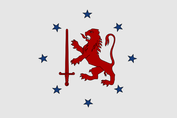
Flag Description: The flag consists of a white field. In the center is a red lion rampant facing the hoist (left from the viewer's perspective), holding an upright red sword in its right paw. This central design is encircled by eight blue five-pointed stars outlined in black.
Symbolism: The red lion holding a sword is derived from the historical coat of arms of the territory. The eight blue five-pointed stars arranged in a circle represent the eight merged municipalities (Aaigem, Bambrugge, Burst, Erpe, Erondegem, Ottegem, Mere, and Vlekkem) that form the present-day municipality of Erpe-Mere.
Statistics
Area
40.03 km²
Population
20,845