Fertőd
Digital Passport
Nomenclature and Geography
Category: City / Municipality
Summary
About the place: Fertőd is a town in the Győr-Moson-Sopron county of Hungary, located near the Austrian border and Lake Neusiedl. It is famous for the Esterházy Palace, often referred to as the 'Hungarian Versailles'.
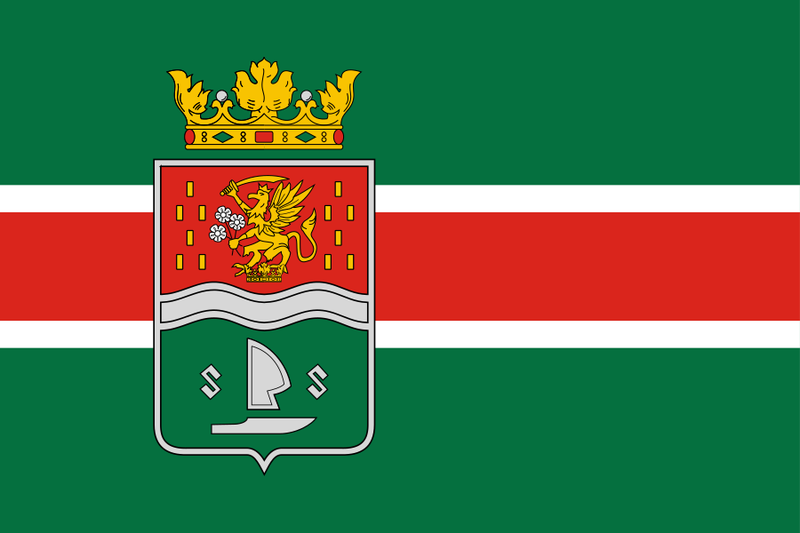
Flag Description: The flag consists of a green field with three horizontal stripes in the center: a narrow white stripe, a wider red stripe, and a narrow white stripe. On the hoist side, the town coat of arms is placed over these stripes, surmounted by a golden coronet. The shield is divided by a silver wavy bar; the upper red field depicts a golden crowned griffin holding a sword and flowers surrounded by golden billets, while the lower green field displays a silver coulter, plowshare, and two letters 'S'.
Symbolism: The green color and the wavy bar in the coat of arms reference the surrounding landscape and nearby Lake Neusiedl. The griffin originates from the coat of arms of the Esterházy family, who profoundly shaped the town's history. The agricultural tools and the letters 'S' in the lower field commemorate the historical agricultural roots and former constituent villages such as Süttör.
Statistics
Area
42.84 km²
Population
3,400