Geretsried
Digital Passport
Nomenclature and Geography
Category: City / Municipality
Summary
About the place: Geretsried is a town located in the Bad Tölz-Wolfratshausen district in Upper Bavaria, situated between the Isar and Loisach rivers. It is the youngest and largest town in the district, established after World War II on the site of former industrial plants.
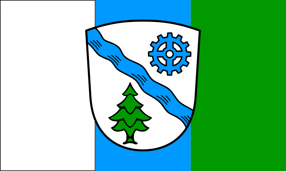
Flag Description: The flag consists of a proportions 3:5 sheet with three vertical stripes: white, blue, and green. In the center of the flag is the town's coat of arms. The coat of arms features a silver (white) shield divided by a diagonal blue wavy bend. In the upper left from the viewer's perspective (heraldic dexter chief) is a blue cogwheel, and in the lower right from the viewer's perspective (heraldic sinister base) is a green fir tree.
Symbolism: The colors of the flag and the elements in the coat of arms reflect the character and history of the town. The blue wavy bend symbolizes the Isar River bordering the town's area. The blue cogwheel represents industrial development and the modern history of the town founded in the mid-20th century. The green fir tree and green stripe refer to the surrounding deep forests and natural landscape of the region. The white and blue colors also evoke the traditional Bavarian state colors.
Statistics
Area
24.65 km²
Population
25,623