Grobbendonk
Digital Passport
Nomenclature and Geography
Category: City / Municipality
Summary
About the place: Grobbendonk is a municipality located in the Belgian province of Antwerp, Flanders. Situated in the Kempen region along the Little Nete river, it comprises the sub-municipalities of Grobbendonk and Bouwel.
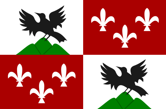
Flag Description: The flag is quartered. The first and fourth white quarters each display a black bird with spread wings perched on a green triple mount. The second and third red quarters each feature three white fleur-de-lis arranged two and one.
Symbolism: The flag combines historical motifs from both sub-municipalities. The first and fourth quarters display the arms of the former municipality of Grobbendonk (a black raven on a triple mount, derived from the Schetz/Ursel family), while the second and third quarters bear three fleur-de-lis representing the former municipality of Bouwel.
Statistics
Area
28.36 km²
Population
11,442