Gruna
Digital Passport
Nomenclature and Geography
Category: City / Municipality
Summary
About the place: Gruna is a village and municipality in the Svitavy District of the Pardubice Region, situated northeast of Moravská Třebová in the historic Hřebečsko (Schönhengstgau) region. It is a rural agricultural community set in the gently rolling landscape of the Orlické Foothills.
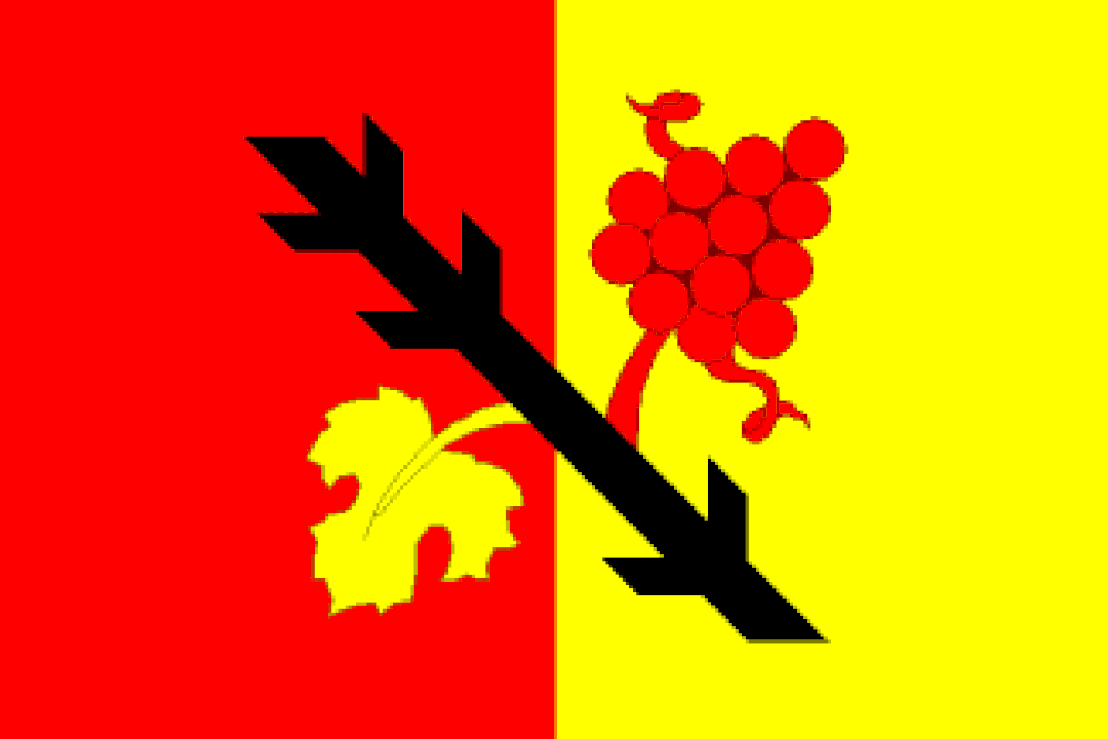
Flag Description: The flag consists of two vertical stripes, red and yellow. In the center is a bendwise black ragged staff (raguly trunk/ostrev), from which a yellow grape leaf grows into the red stripe and an erect red bunch of grapes grows into the yellow stripe. The ratio of the flag's width to length is 2:3.
Symbolism: The black ragged trunk (ostrev) refers to the Lords of Lipá and the historical connection to the Moravská Třebová estate. The grape cluster and vine leaf symbolize local agriculture and historical viticulture in the region, while the red and yellow (gold) colors reflect the traditional heraldic tinctures of the territorial domain.
Statistics
Area
10.37 km²
Population
254