Guarapuava
Digital Passport
Nomenclature and Geography
Category: City / Municipality
Summary
About the place: Guarapuava is a prominent municipality and city located in the southern Brazilian state of Paraná. Situated on a high plateau, it is known as one of the highest and coldest urban areas in the state.
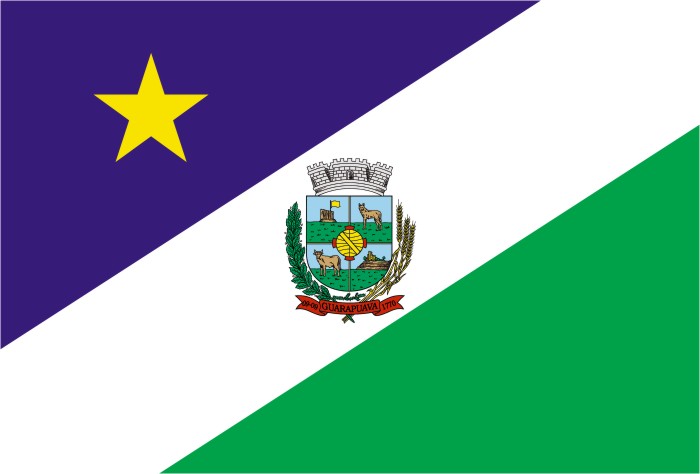
Flag Description: The flag is divided diagonally from the lower hoist (observer's bottom-left) to the upper fly (observer's top-right) by a broad white bend. The upper triangle is dark blue/violet featuring a yellow five-pointed star in the upper hoist area. The lower triangle is green. In the center of the white bend sits the coat of arms of Guarapuava, consisting of a shield depicting local scenes, flanked by crop branches, topped with a mural crown, and accompanied by a red scroll with the municipality's name.
Symbolism: The blue field and yellow star represent the sky and guidance/pioneer spirit, white stands for peace and purity, and green represents the natural riches, forests, and agriculture of the region. The central coat of arms highlights the municipality's history and agricultural heritage.
Statistics
Area
3,168.20 km²
Population
182,644