Habrovany
Digital Passport
Nomenclature and Geography
Category: City / Municipality
Summary
About the place: Habrovany is a small rural municipality located in the Ústí nad Labem District within the České středohoří mountains of the Czech Republic.
Flag Description: Habrovany is a municipality and village located in the Ústí nad Labem District of the Ústí nad Labem Region in the Czech Republic, situated in the České středohoří (Bohemian Central Uplands). The rural community lies in an undulating landscape at an elevation of approximately 238 meters above sea level.
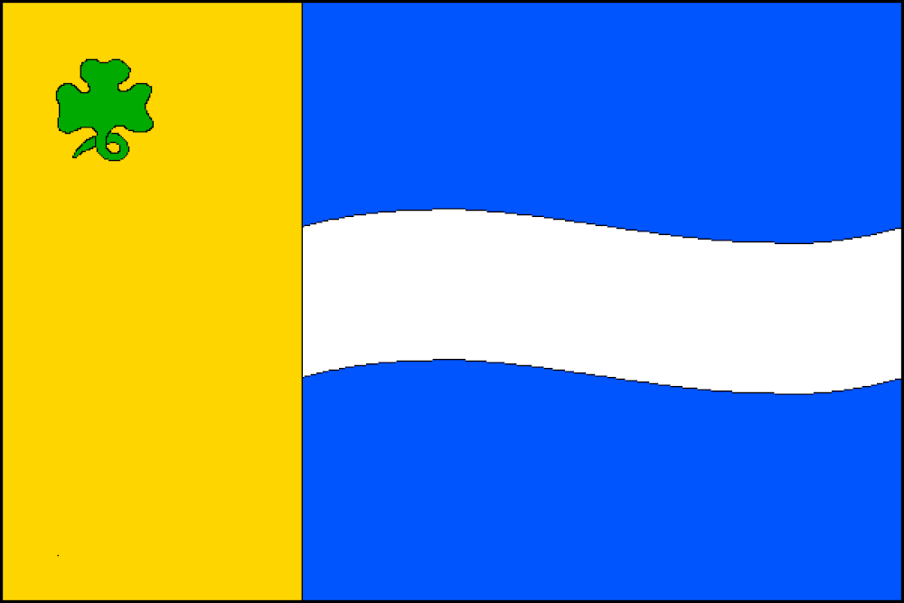
Symbolism: The symbolism reflects the natural environment and local geography. The yellow color together with the green trefoil symbolizes agriculture, local flora, and rural greenery. The blue field combined with the white (silver) wavy stripe represents local watercourses (notably the Radejčín Brook) flowing through the municipality's territory.
Flag Description: Habrovany is a municipality and village located in the Ústí nad Labem District of the Ústí nad Labem Region in the Czech Republic, situated in the České středohoří (Bohemian Central Uplands). The rural community lies in an undulating landscape at an elevation of approximately 238 meters above sea level.
Symbolism: The symbolism reflects the natural environment and local geography. The yellow color together with the green trefoil symbolizes agriculture, local flora, and rural greenery. The blue field combined with the white (silver) wavy stripe represents local watercourses (notably the Radejčín Brook) flowing through the municipality's territory.
Statistics
Area
2.82 km²
Population
221