Hajnice
Digital Passport
Nomenclature and Geography
Category: City / Municipality
Summary
About the place: Hajnice is a rural municipality in the Trutnov District of the Hradec Králové Region, situated southeast of the town of Trutnov. It lies in the rolling, heavily forested landscape of the Giant Mountains foothills (Krkonošské podhůří) along the Běluňka stream and comprises several historically distinct settlements.
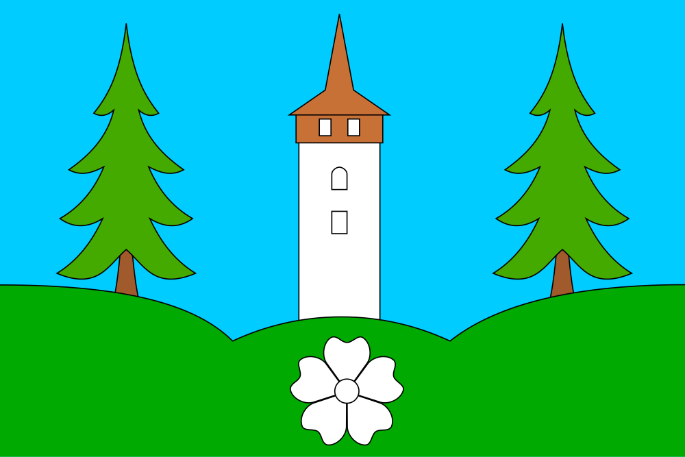
Flag Description: A light blue field with a green triple mount issuing from the bottom edge and the lower two-fifths (fourth and fifth fifths) of the hoist and fly edges. Rising from the lower middle peak is a white tower with brown timber cladding and a pointed brown roof, flanked on the outer peaks by two green spruce trees with brown trunks. In the middle peak is a white flax flower. The ratio of the flag's width to length is 2:3.
Symbolism: The blue field symbolizes the local streams and the clear skies of the foothills. The green triple mount and spruce trees represent the rolling, forested landscape of the Giant Mountains foothills as well as the name Hajnice (historically related to woods and forestry). The white tower with timber cladding depicts the municipality's prominent landmark: the historic late Gothic and Renaissance freestanding bell and watchtower at the Church of St. Nicholas in Brusnice. The white flax flower commemorates the regional tradition of flax cultivation and textile weaving, with its center and petals also metaphorically representing the municipal center and the constituent local settlements.
Statistics
Area
31.71 km²
Population
1,122