Hamr
Digital Passport
Nomenclature and Geography
Category: City / Municipality
Summary
About the place: Hamr is a South Bohemian municipality located in the Jindřichův Hradec District within the Třeboňsko Protected Landscape Area. It features a scenic rural and recreational character surrounded by extensive forests and fishponds near the Lužnice and Nežárka rivers.
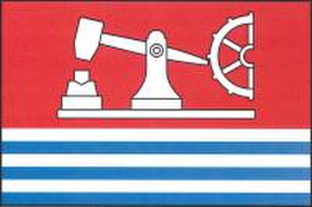
Flag Description: The flag consists of seven horizontal stripes: red and alternating white and blue, in a width ratio of 10 : 1 : 1 : 1 : 1 : 1 : 1. In the upper wide red stripe, there is a white tilt hammer (tail hammer) with half of a cam wheel. The ratio of the flag's width to its length is 2 : 3.
Symbolism: The white tilt hammer with a cam wheel is a canting symbol referencing the municipality's name ('Hamr' means iron forge/hammer) and the historical ironworking tradition driven by watermills. The alternating white and blue stripes at the bottom symbolize the watercourses of the Třeboň region—notably the Lužnice and Nežárka rivers and local fishponds—which supplied water power for the hammers. The red and white colors also evoke Bohemian territorial heraldry.
Statistics
Area
11.95 km²
Population
368