Hamry nad Sázavou
Digital Passport
Nomenclature and Geography
Category: City / Municipality
Summary
About the place: Hamry nad Sázavou is a municipality in the Vysočina Region of the Czech Republic, situated along the Sázava River on the historical border between Bohemia and Moravia.
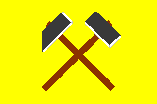
Flag Description: On a yellow field, a stonemason's mallet placed bendwise-sinister is surmounted by a hammer-mill hammer placed bendwise. Both tools have black heads with white highlights and brown handles.
Symbolism: The stonemason's mallet and hammer-mill hammer symbolize the historical iron ore mining, traditional water-powered forge hammering (hamry), and stone-working industries that shaped the village and gave it its name.
Statistics
Area
7.12 km²
Population
1,594