Havixbeck
Digital Passport
Nomenclature and Geography
Category: City / Municipality
Summary
About the place: Havixbeck is a municipality in the district of Coesfeld, in North Rhine-Westphalia, Germany, situated at the foot of the Baumberge hills near Münster.
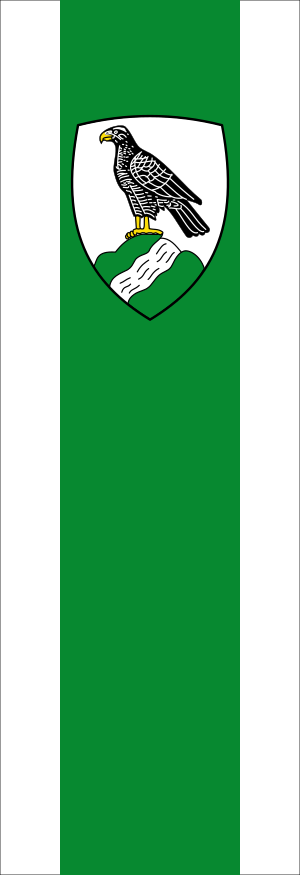
Flag Description: The banner of the municipality of Havixbeck is vertically oriented, composed of three vertical stripes in a width ratio of 1:3:1 in white, green, and white. In the upper half of the wider central green stripe, the municipal coat of arms is displayed. The coat of arms features a white (silver) shield showing a black bird of prey (hawk) with gold (yellow) beak and talons standing on a green triple hill. A silver (white) wavy stream flows diagonally across the triple hill.
Symbolism: The bird on the triple hill represents a hawk (German: Habicht), which is a canting element referring to the name Havixbeck (historically Havkesbeke = hawk's brook). The green triple hill symbolizes the hilly landscape of the Baumberge region, and the wavy stream depicts the brook (Beck/Bach) from which the municipality derives its name. The green color on the flag represents the surrounding natural landscape and forests.
Statistics
Area
53.18 km²
Population
12,053