Heřmaň
Digital Passport
Nomenclature and Geography
Category: City / Municipality
Summary
About the place: Heřmaň is a village and municipality in the Písek District of the South Bohemian Region, Czechia, situated approximately 9 km south of Písek on the left bank of the Blanice River. It is set in an undulating agricultural landscape characterized by ponds and watercourses.
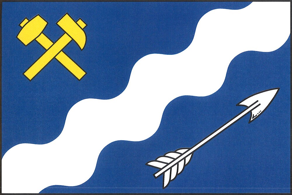
Flag Description: A blue field with an aspect ratio of 2:3 featuring a bendwise sinister wavy white stripe two-sevenths of the flag's width. In the upper hoist field is a bendwise hammer crossed bendwise sinister by a mallet, both yellow. In the lower fly field is a bendwise white arrow pointing toward the upper fly edge.
Symbolism: The white wavy stripe on the blue field symbolizes the Blanice River flowing past the village and the surrounding waters. The crossed miner's hammers represent the region's historical mining heritage, while the arrow is a heraldic charge referencing historical local nobility and traditions.
Statistics
Area
7.05 km²
Population
321