Horka u Staré Paky
Digital Passport
Nomenclature and Geography
Category: City / Municipality
Summary
About the place: Horka u Staré Paky is a small municipality in the Krkonoše foothills, situated in the Semily District of the Liberec Region at an elevation of approximately 503 meters above sea level. It comprises two parts (Horka u Staré Paky and Nedaříž) and serves as an important local transportation crossroads for both road and rail routes.
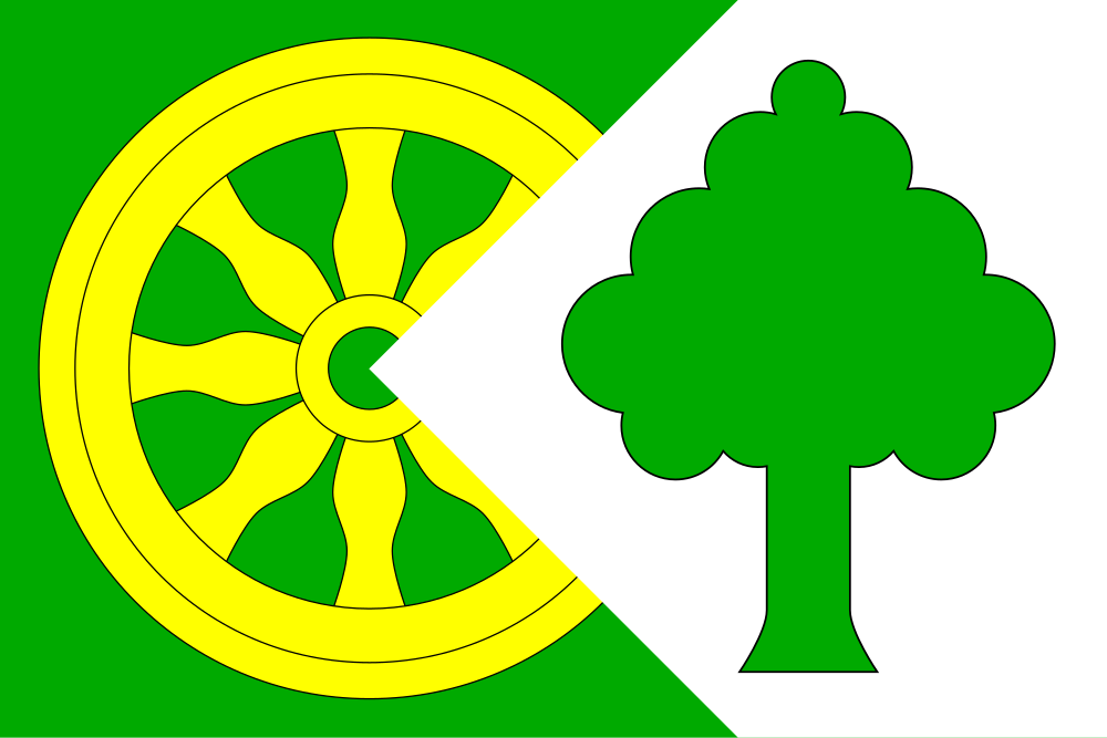
Flag Description: A green field charged with a yellow cart wheel in the hoist and central section, overlaid by a white fly-directed pentagonal field extending from the fly edge (occupying one-third of the fly edge length) with its apex in the first third of the flag's length from the hoist, charged with a green deciduous tree. The ratio of width to length is 2:3.
Symbolism: The golden wagon wheel commemorates the settlement's founding in 1823 at the crossroads of trade routes as an important carters' and coaching waystation with a renowned inn ('Formanka'). The white wedge/pile serves as a canting element referring to the municipality's name ('horka' meaning an elevation or hill) as well as the road junction. The green field and deciduous tree represent the lush forests and picturesque landscape of the Krkonoše foothills.
Statistics
Area
2.03 km²
Population
232