Horní Bludovice
Digital Passport
Nomenclature and Geography
Category: City / Municipality
Summary
About the place: Horní Bludovice is a municipality in the Moravian-Silesian Region (Karviná District), situated in the historical region of Cieszyn Silesia immediately south of the city of Havířov near the Těrlicko and Žermanice reservoirs. It features a predominantly residential and rural agricultural character set in the undulating foothills of the Western Beskids.
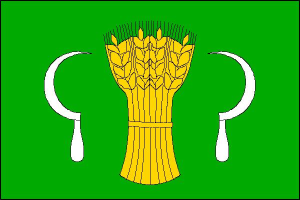
Flag Description: A green field with a yellow wheatsheaf in the center between two white sickles facing inward. The ratio of width to length is 2:3.
Symbolism: The green field represents the surrounding countryside, nature, and the rural landscape of the Beskid foothills. The golden wheatsheaf and silver sickles derive from historical municipal seals, symbolizing agricultural heritage, fertility, harvest, and industrious labor.
Statistics
Area
8.98 km²
Population
2,591