Horní Bukovina
Digital Passport
Nomenclature and Geography
Category: City / Municipality
Summary
About the place: Horní Bukovina is a municipality in the Central Bohemian Region (Mladá Boleslav District) of the Czech Republic, situated in the gently rolling landscape of the Jizera Table near Mnichovo Hradiště. The municipality lies along the Zábrdka stream and is composed of two administrative parts: Horní Bukovina and Dolní Bukovina.
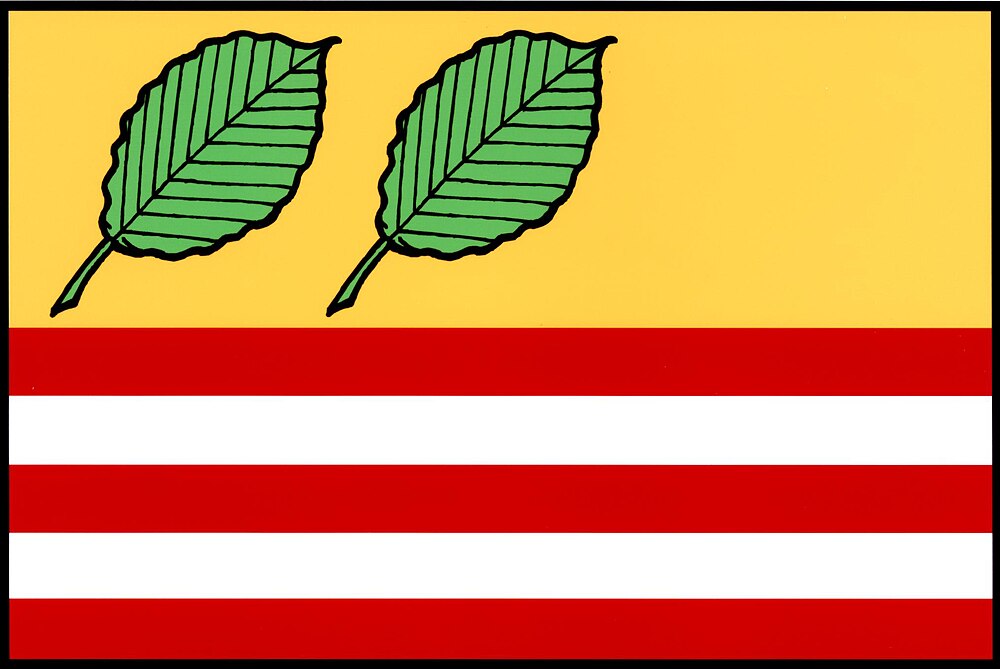
Flag Description: The flag consists of six horizontal stripes: a yellow stripe and five alternating red and white stripes in a width ratio of 5:1:1:1:1:1. In the hoist and center parts of the upper yellow stripe, there are two green beech leaves positioned bendwise. The ratio of the flag's width to length is 2:3.
Symbolism: The flag is derived from the municipal coat of arms granted in 2009. The beech leaves serve as a canting charge referencing the municipality's name (derived from the Czech word for beech, 'buk'), with their count of two symbolizing the two constituent parts of the village—Horní Bukovina and Dolní Bukovina. The five alternating red and white stripes at the bottom correspond to the two silver bars in the red field of the coat of arms and represent the Zábrdka stream flowing through the municipality.
Statistics
Area
5.54 km²
Population
279