Horní Kněžeklady
Digital Passport
Nomenclature and Geography
Category: City / Municipality
Summary
About the place: Horní Kněžeklady is a small South Bohemian municipality situated in the České Budějovice District, located in a gently rolling agricultural and forested landscape roughly 7 km southeast of Týn nad Vltavou. The municipality consists of three administrative parts: Horní Kněžeklady, Dolní Kněžeklady, and Štipoklasy.
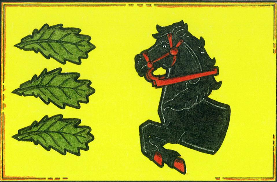
Flag Description: A yellow field. In the hoist portion, three horizontal green oak leaves arranged vertically with stems pointing to the hoist; in the center and fly portion, the forward half of a black horse with red hooves and red bridle. The ratio of width to length is 2 : 3.
Symbolism: The half of a black horse on a yellow field refers to the historical local nobility and gentry of the Týn nad Vltavou domain as well as traditional agricultural heritage, with the gold/yellow color recalling early ecclesiastical ownership (Bishopric of Prague). The three oak leaves symbolize the surrounding woodland wealth, the local historical oak alley, and the three constituent settlements of the municipality, while also echoing the toponymic origin linked to timber and logs.
Statistics
Area
7.85 km²
Population
110