Horní Lhota (Zlín District)
Digital Passport
Nomenclature and Geography
Category: City / Municipality
Summary
About the place: Horní Lhota is a municipality and village in the Zlín District of the Zlín Region, located in the hilly landscape of the Vizovice Highlands near the spa town of Luhačovice.
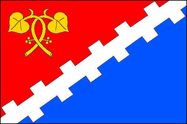
Flag Description: A flag divided diagonally from the upper fly to the lower hoist by a white embattled bend sinister into red and blue fields. In the upper hoist corner are two yellow linden sprigs crossed twice, each bearing one leaf and fruit. The width-to-length ratio is 2:3.
Symbolism: The embattled division and white bend reference the historical defensive and watch function of the settlement linked to the ruined castle of Engelsberg (Sehrad). The twice-crossed linden sprigs with fruit represent the surrounding natural landscape of the Vizovice Highlands and the Czech national tree, while the red and blue colors stem from the municipal coat of arms featuring an angel.
Statistics
Area
12.65 km²
Population
602