Horní Meziříčko
Digital Passport
Nomenclature and Geography
Category: City / Municipality
Summary
About the place: Horní Meziříčko is a small municipality in the Jindřichův Hradec District within the South Bohemian Region, situated in the picturesque landscape of the Javořice Highlands along the historical Bohemian-Moravian border. It lies in gently rolling countryside characterized by forests and ponds, east of Strmilov.
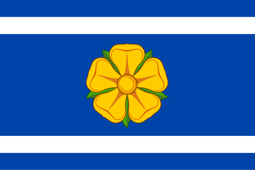
Flag Description: The flag consists of five horizontal stripes, alternately blue and white, in a width ratio of 1:1:6:1:1. The central broad blue stripe bears a yellow rose. The width-to-length ratio of the flag is 2:3.
Symbolism: The golden rose in a blue field directly references the Lords of Neuhaus (páni z Hradce, a branch of the Vítkovci dynasty), who historically colonized and ruled the region. The two white stripes (corresponding to the silver wavy bars on the coat of arms) symbolize the local streams and ponds while serving as a canting element for the village's name (Meziříčko = 'between little rivers/streams').
Statistics
Area
4.40 km²
Population
110