Horní Moštěnice
Digital Passport
Nomenclature and Geography
Category: City / Municipality
Summary
About the place: Horní Moštěnice is a Moravian municipality situated in Přerov District in the Olomouc Region, located just south of the town of Přerov along the Moštěnka River. The area is set within the fertile Haná region and boasts a rich history of settlement extending back to the Great Moravian period.
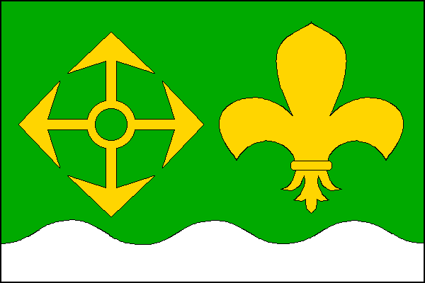
Flag Description: The flag consists of two horizontal stripes, green and wavy white with three crests and two troughs, in a width ratio of 7 : 2. In the hoist half of the green stripe is a four-pointed arrow cross (winged/flying arrow), in the fly half a fleur-de-lis, both yellow. The ratio of the flag width to its length is 2 : 3.
Symbolism: The symbolism is derived from the municipal coat of arms granted in 2005. The four-pointed arrow cross (rozletitá střela) originates from the historical village seal of 1656 and represents the coat of arms of the former lords, the House of Švábenice. The yellow fleur-de-lis and green color represent the Virgin Mary, patron saint of the local parish Church of the Assumption of the Virgin Mary, and the wavy white stripe symbolizes the Moštěnka River flowing through the municipality.
Statistics
Area
9.82 km²
Population
1,676