Horní Podluží
Digital Passport
Nomenclature and Geography
Category: City / Municipality
Summary
About the place: Horní Podluží is a municipality in the Děčín District of the Ústí nad Labem Region, situated along the Lužnička stream on the border between the Lusatian Mountains and Bohemian Switzerland. It is primarily a residential and recreational community neighboring Dolní Podluží and Rybniště.
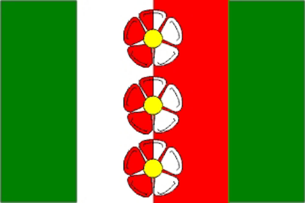
Flag Description: The flag consists of four vertical stripes: green, white, red, and green. Centered along the partition line between the white and red stripes are three roses in counterchanged colors arranged vertically in pale, each with yellow seeds. The width-to-length ratio of the flag is 2:3.
Symbolism: The white-and-red vertical partition charged with three counterchanged roses is derived from the coat of arms of the noble Schleinitz family, historical lords of the Tolštejn estate who significantly developed the area. The green stripes symbolize the surrounding natural landscape, the forests of the Lusatian Mountains, agriculture, and local textile traditions.
Flag Description: The flag consists of four vertical stripes: green, white, red, and green. Centered along the partition line between the white and red stripes are three roses in counterchanged colors arranged vertically in pale, each with yellow seeds. The width-to-length ratio of the flag is 2:3.
Symbolism: The white-and-red vertical partition charged with three counterchanged roses is derived from the coat of arms of the noble Schleinitz family, historical lords of the Tolštejn estate who significantly developed the area. The green stripes symbolize the surrounding natural landscape, the forests of the Lusatian Mountains, agriculture, and local textile traditions.
Statistics
Area
7.41 km²
Population
825