Horní Rožínka
Digital Passport
Nomenclature and Geography
Category: City / Municipality
Summary
About the place: Horní Rožínka is a small rural municipality in the Žďár nad Sázavou District within the Vysočina Region of the Czech Republic, situated in the Křižanov Highlands about 8 km west of Bystřice nad Pernštejnem. The village is characterized by its agricultural heritage and peaceful countryside setting.
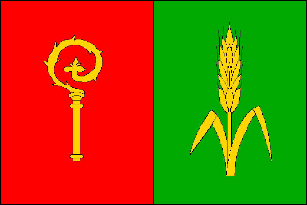
Flag Description: Vertically divided red and green flag with an aspect ratio of 2:3. The red hoist stripe features a yellow crozier head with its crook turned toward the fly; the green fly stripe features a yellow ear of wheat with two leaves.
Symbolism: The golden crozier head commemorates the village's historical feudal ties to the Cistercian monastery in Žďár nad Sázavou (reflected in its former name Opatská Rožínka). The ear of wheat with two leaves is derived from the village's historic Baroque seal, symbolizing local farming traditions. The red and green colors represent the surrounding natural landscape (meadows, fields, and forests) and recall the clearing of forest land by fire during medieval colonization.
Flag Description: Vertically divided red and green flag with an aspect ratio of 2:3. The red hoist stripe features a yellow crozier head with its crook turned toward the fly; the green fly stripe features a yellow ear of wheat with two leaves.
Symbolism: The golden crozier head commemorates the village's historical feudal ties to the Cistercian monastery in Žďár nad Sázavou (reflected in its former name Opatská Rožínka). The ear of wheat with two leaves is derived from the village's historic Baroque seal, symbolizing local farming traditions. The red and green colors represent the surrounding natural landscape (meadows, fields, and forests) and recall the clearing of forest land by fire during medieval colonization.
Statistics
Area
2.03 km²
Population
90