Horní Vltavice
Digital Passport
Nomenclature and Geography
Category: City / Municipality
Summary
About the place: Horní Vltavice is a mountain municipality in Prachatice District within the South Bohemian Region of Czechia, situated in the Bohemian Forest along the Warm Vltava river valley near Mount Boubín and the Bavarian border.
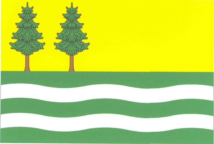
Flag Description: The flag of Horní Vltavice has a width-to-length ratio of 2:3 and consists of six horizontal stripes: yellow, green, wavy white, green, white, and undy green in a ratio of 5 : 1 : 1 : 1 : 1 : 1. Growing from the lower edge in the hoist half of the broad yellow stripe are two green spruce trees with brown trunks.
Symbolism: The wavy white stripes represent the Warm Vltava River, from which the municipality derives its name. The green stripes and the two spruce trees set against the yellow (gold) field symbolize the dense forests of the Bohemian Forest (Šumava) and the surrounding natural mountain landscape.
Statistics
Area
58.80 km²
Population
350