Hořovice
Digital Passport
Nomenclature and Geography
Category: City / Municipality
Summary
About the place: Hořovice is a historic town in Beroun District within the Central Bohemian Region of the Czech Republic, situated along the Červený potok stream between the Brdy Highlands and Křivoklát Highlands. It serves as a regional hub for the Podbrdsko area and is renowned for its Old and New Châteaux and a rich ironworking heritage.
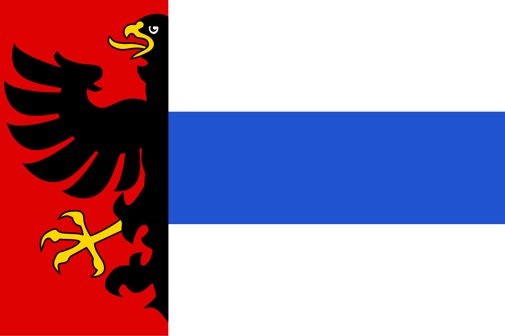
Flag Description: A flag with an aspect ratio of 2:3 composed of a red hoist stripe occupying one-third of the flag's length and three horizontal stripes in the fly section of white, blue, and white. Issuing from the partition line in the red stripe toward the hoist is a demi-eagle sable armed and langued or (yellow).
Symbolism: The flag is directly derived from the historic municipal coat of arms, which combines elements of noble dynasties tied to the town's founding and governance. The demi-eagle sable on red represents the Lords of Žirotín, notably Plichta of Žirotín, who played a key role in founding the town in the early 14th century. The blue horizontal stripe flanked by two white stripes mirrors the blue fess on a silver field from the arms, symbolizing subsequent lordships and royal associations.
Flag Description: A flag with an aspect ratio of 2:3 composed of a red hoist stripe occupying one-third of the flag's length and three horizontal stripes in the fly section of white, blue, and white. Issuing from the partition line in the red stripe toward the hoist is a demi-eagle sable armed and langued or (yellow).
Symbolism: The flag is directly derived from the historic municipal coat of arms, which combines elements of noble dynasties tied to the town's founding and governance. The demi-eagle sable on red represents the Lords of Žirotín, notably Plichta of Žirotín, who played a key role in founding the town in the early 14th century. The blue horizontal stripe flanked by two white stripes mirrors the blue fess on a silver field from the arms, symbolizing subsequent lordships and royal associations.
Statistics
Area
9.55 km²
Population
8,055