Hradčany (Přerov District)
Digital Passport
Nomenclature and Geography
Category: City / Municipality
Summary
About the place: The municipality of Hradčany is located in Přerov District in the Olomouc Region (Záhoří region), roughly 10 km east of Přerov. It covers an area of 5.32 km² and has a population of around 330–340.
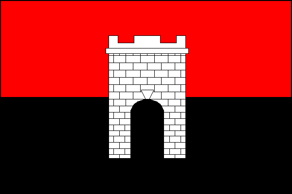
Flag Description: Hradčany is a municipality and village in Přerov District in the Olomouc Region of the Czech Republic, situated in the Záhoří region about 10 km east of Přerov. It is a small rural community set in the gently undulating landscape between the Haná region and the Moravian Gate.
Symbolism: The red and black colours are derived from the traditional historical banner of the local Moravian sub-region of Záhoří. The white embattled castle tower is a canting charge referencing the municipality's name (Czech 'hrad' meaning castle – Hradčany). The municipal symbols were designed by the prominent Czech heraldist Jiří Louda.
Statistics
Area
5.32 km²
Population
339