Hradec
Digital Passport
Nomenclature and Geography
Category: City / Municipality
Summary
About the place: Hradec (often referred to as Hradec u Stoda) is a municipality and village in the Plzeň-South District of the Plzeň Region, situated on the left bank of the Radbuza River about 4 km southwest of the town of Stod. The location is widely known for the archaeological remains of a major early medieval Slavic hillfort that once guarded a historic trade route into Bavaria.
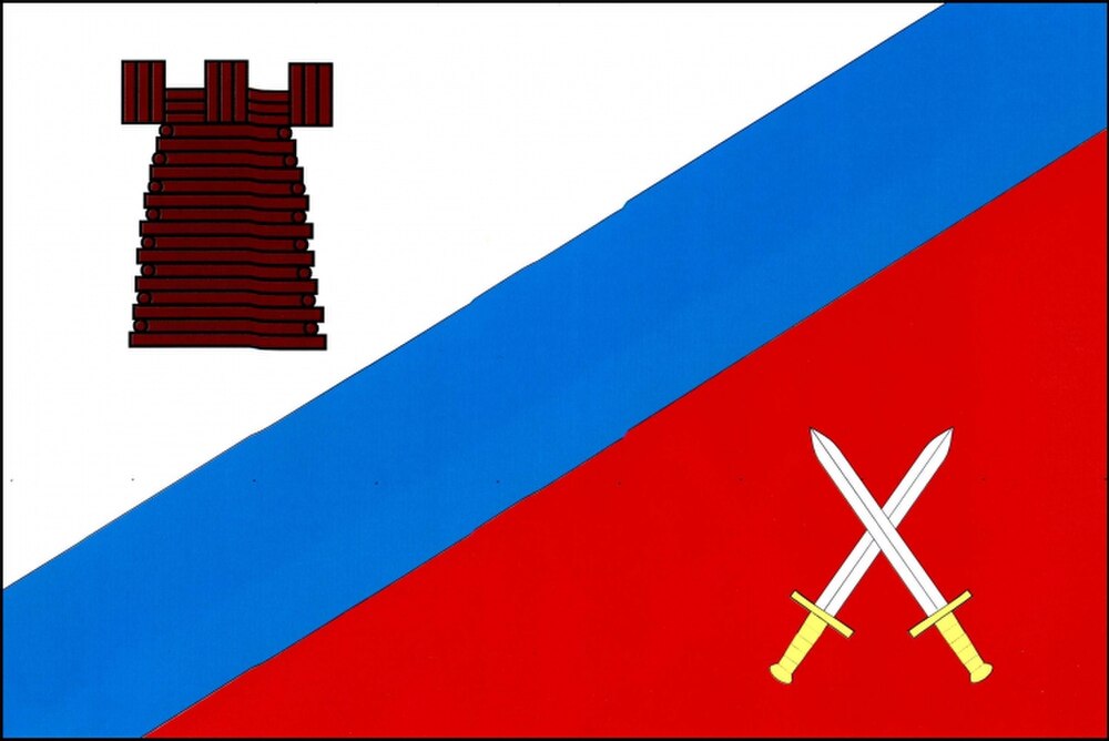
Flag Description: The flag is divided by a blue diagonal bend one-fifth of the flag's length in width into a white hoist field and a red fly field. In the white field is a brown palisade tower with battlements; in the red field are two crossed white swords with yellow hilts, points pointing upwards. The ratio of width to length is 2:3.
Symbolism: The brown palisade tower serves as a canting symbol referencing the municipality's name (Hradec = hillfort or fortified settlement) and commemorating the extensive wooden-and-earthen fortifications of the 9th–13th-century early medieval stronghold. The crossed swords represent the defensive and strategic significance of the fort guarding trade routes, as well as archaeological military artifacts uncovered in the area. The blue diagonal bend represents the Radbuza River flowing alongside the village, while white and red reflect the traditional regional colors of Bohemia.
Statistics
Area
6.73 km²
Population
620