Hranice
Digital Passport
Nomenclature and Geography
Category: City / Municipality
Summary
About the place: Hranice is a rural municipality in the České Budějovice District of the South Bohemian Region, situated in a forested peatland landscape near Nové Hrady along the historical Bohemian-Austrian border.
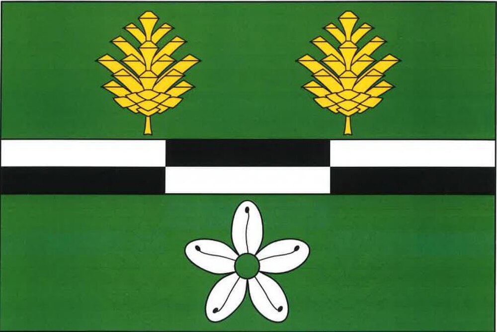
Flag Description: The flag consists of three horizontal stripes of green, white-and-black masoned (two rows of three bricks each), and green, in a ratio of 5 : 2 : 5. In the upper green stripe are two erect yellow pine cones side by side; in the lower green stripe is a white five-petalled wild rosemary flower with a green center. The width-to-length ratio of the flag is 2 : 3.
Symbolism: The green color symbolizes the surrounding forests and natural rural landscape. The white-and-black masoned stripe serves as a canting charge representing the municipality's name ('Hranice' meaning border) and its historical position on the Bohemian-Austrian frontier (the white rectangles evoke boundary stones, while the black ones represent cut peat bricks historically harvested in the area). The two golden pine cones represent the bog pine (Pinus rotundata) and the municipality's two constituent parts (Hranice and Trpnouze). The marsh Labrador tea (wild rosemary) flower represents the typical and protected peatland flora of the surrounding reserves (such as NPR Žofinka).
Flag Description: The flag consists of three horizontal stripes of green, white-and-black masoned (two rows of three bricks each), and green, in a ratio of 5 : 2 : 5. In the upper green stripe are two erect yellow pine cones side by side; in the lower green stripe is a white five-petalled wild rosemary flower with a green center. The width-to-length ratio of the flag is 2 : 3.
Symbolism: The green color symbolizes the surrounding forests and natural rural landscape. The white-and-black masoned stripe serves as a canting charge representing the municipality's name ('Hranice' meaning border) and its historical position on the Bohemian-Austrian frontier (the white rectangles evoke boundary stones, while the black ones represent cut peat bricks historically harvested in the area). The two golden pine cones represent the bog pine (Pinus rotundata) and the municipality's two constituent parts (Hranice and Trpnouze). The marsh Labrador tea (wild rosemary) flower represents the typical and protected peatland flora of the surrounding reserves (such as NPR Žofinka).
Statistics
Area
7.22 km²
Population
212