Hraničné Petrovice
Digital Passport
Nomenclature and Geography
Category: City / Municipality
Summary
About the place: Hraničné Petrovice is a small rural municipality in the Olomouc District of the Olomouc Region, situated in the Nízký Jeseník highlands northeast of Šternberk. The village is set in an undulating sub-mountain landscape, known also for its local wind energy park.
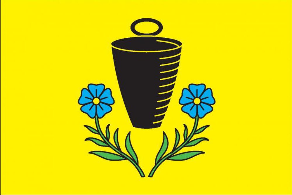
Flag Description: Yellow field featuring a black tin milk pail (hrotek) flanked below and on the sides by two divergent green flax stems with leaves, each terminating in a blue flower with a yellow center. The ratio of the flag's width to length is 2:3.
Symbolism: The black tin pail (a traditional milking pail or 'hrotek') derives from the municipal stamp used in the interwar period (around 1937), representing dairy farming and cattle breeding. The flax stems and blue flowers, together with the yellow background, symbolize traditional agriculture and historical flax cultivation in the region. The symbols were designed by Jan Tejkal and granted in 2017.
Flag Description: Yellow field featuring a black tin milk pail (hrotek) flanked below and on the sides by two divergent green flax stems with leaves, each terminating in a blue flower with a yellow center. The ratio of the flag's width to length is 2:3.
Symbolism: The black tin pail (a traditional milking pail or 'hrotek') derives from the municipal stamp used in the interwar period (around 1937), representing dairy farming and cattle breeding. The flax stems and blue flowers, together with the yellow background, symbolize traditional agriculture and historical flax cultivation in the region. The symbols were designed by Jan Tejkal and granted in 2017.
Statistics
Area
12.15 km²
Population
141