Hrušky (Vyškov District)
Digital Passport
Nomenclature and Geography
Category: City / Municipality
Summary
About the place: Hrušky is a South Moravian village and municipality situated in Vyškov District, approximately 5 km southwest of Slavkov u Brna in the fertile agricultural lowland of the Dyje–Svratka Valley. The municipality retains a distinct rural character with a historical heritage tied to both the Knights Hospitaller and the Slavkov estate.
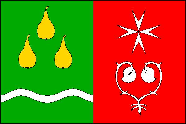
Flag Description: The flag consists of two vertical stripes, green and red. In the hoist green stripe are three (1, 2) yellow pears above a white wavy stripe with a width of one-twentieth of the flag's width, positioned one-fifth of the flag's width from the lower edge. In the fly red stripe is a white Maltese cross above uprooted white water lily leaves (seeblätter). The width-to-length ratio of the flag is 2:3.
Symbolism: The pears represent canting heraldry referencing the village's name (historically also known in German as Birnbaum). The white wavy stripe symbolizes the local watercourse. The white Maltese cross commemorates the Knights Hospitaller (Maltese Order), who historically owned part of the village. The uprooted water lily leaves (Czech 'lekna') are derived from the coat of arms of the House of Kaunitz, longtime owners of the Slavkov (Austerlitz) estate to which the settlement belonged.
Flag Description: The flag consists of two vertical stripes, green and red. In the hoist green stripe are three (1, 2) yellow pears above a white wavy stripe with a width of one-twentieth of the flag's width, positioned one-fifth of the flag's width from the lower edge. In the fly red stripe is a white Maltese cross above uprooted white water lily leaves (seeblätter). The width-to-length ratio of the flag is 2:3.
Symbolism: The pears represent canting heraldry referencing the village's name (historically also known in German as Birnbaum). The white wavy stripe symbolizes the local watercourse. The white Maltese cross commemorates the Knights Hospitaller (Maltese Order), who historically owned part of the village. The uprooted water lily leaves (Czech 'lekna') are derived from the coat of arms of the House of Kaunitz, longtime owners of the Slavkov (Austerlitz) estate to which the settlement belonged.
Statistics
Area
5.47 km²
Population
756