Hustopeče nad Bečvou
Digital Passport
Nomenclature and Geography
Category: City / Municipality
Summary
About the place: Hustopeče nad Bečvou is a market town in the Přerov District of the Olomouc Region, situated on the right bank of the Bečva River halfway between Hranice and Valašské Meziříčí. The town is notable for its four-wing Renaissance chateau with an arcaded courtyard and the adjacent Hustopeče gravel lakes.
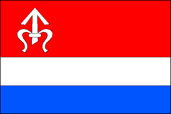
Flag Description: The flag consists of three horizontal stripes of red, white, and blue in a width ratio of 2:1:1. In the hoist part of the red stripe, there is a white coiled arrow (odřivous). The ratio of the flag's width to its length is 2:3.
Symbolism: The white coiled arrow (odřivous) in the red stripe is the heraldic charge of the Lords of Kravaře (from the Benešovici clan), who held the estate during the Middle Ages. The colours red, white, and blue are derived from the municipal coat of arms, which depicts a silver tower on a shield divided per pale red and blue.
Statistics
Area
23.91 km²
Population
1,782