Jindřichov (Přerov District)
Digital Passport
Nomenclature and Geography
Category: City / Municipality
Summary
About the place: Jindřichov (German: Heinrichswald) is a municipality in Přerov District in the Olomouc Region of the Czech Republic, situated in the southern Oder Highlands along the Luha stream, approximately 12 km north of Hranice. It is a traditional upland forest village surrounded by wooded hills.
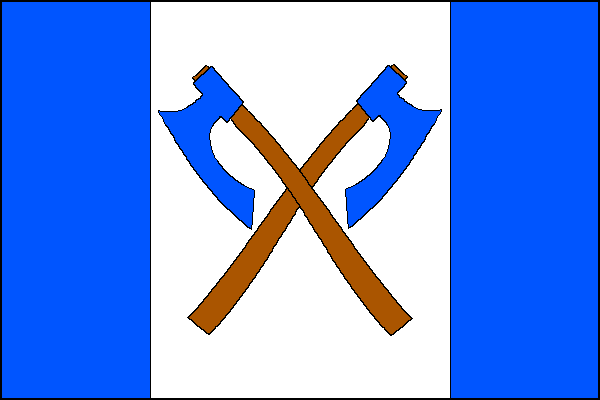
Flag Description: A flag consisting of three vertical stripes of blue, white, and blue in a width ratio of 1:2:1. Centered on the central white stripe are two crossed blue axes with brown hafts. The aspect ratio of the flag is 2:3.
Symbolism: The crossed axes symbolize the village's origins as a forest-clearing settlement (reflected in its historic German name Heinrichswald, meaning 'Heinrich's forest') and recall the traditional forestry and woodcutting heritage of the inhabitants, depicted on historical village seals. The blue and white tinctures derive from the municipal coat of arms and reference the Marian dedication of the local Church of the Assumption of the Virgin Mary.
Statistics
Area
16.45 km²
Population
495