Kamenný Újezd
Digital Passport
Nomenclature and Geography
Category: City / Municipality
Summary
About the place: Kamenný Újezd is a South Bohemian municipality in the České Budějovice District, situated approximately 10 km south of České Budějovice along a historic trade route toward Austria. It lies in the gently undulating landscape of the České Budějovice Basin and the Bohemian Forest foothills near the Vltava River.
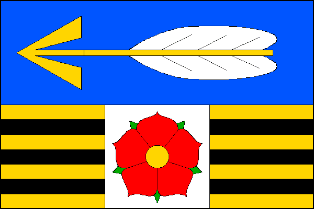
Flag Description: The flag consists of eight horizontal stripes: blue and alternating yellow and black in a width ratio of 7:1:1:1:1:1:1:1. In the upper broad blue stripe is a yellow arrow with white fletching pointing toward the hoist. Overlaid centrally across the lower seven alternating yellow and black stripes is a white square field one-third the length of the sheet wide, charged with a red rose seeded yellow. The ratio of the flag's width to its length is 2:3.
Symbolism: The golden arrow in the blue field is derived from the historic coat of arms of the Lords of Újezd, founders and early medieval rulers of the village in the 13th and 14th centuries. The red five-petaled rose references the House of Rosenberg, who held long-standing regional dominance. The alternating yellow and black stripes represent the historic trade road (leading towards Freistadt and Linz in Austria) that traversed the settlement.
Statistics
Area
28.97 km²
Population
2,694