Klokočí
Digital Passport
Nomenclature and Geography
Category: City / Municipality
Summary
About the place: Klokočí is a village and municipality in Přerov District in the Olomouc Region of the Czech Republic. It is situated in the Oder Mountains foothills, approximately 6 km northeast of Hranice.
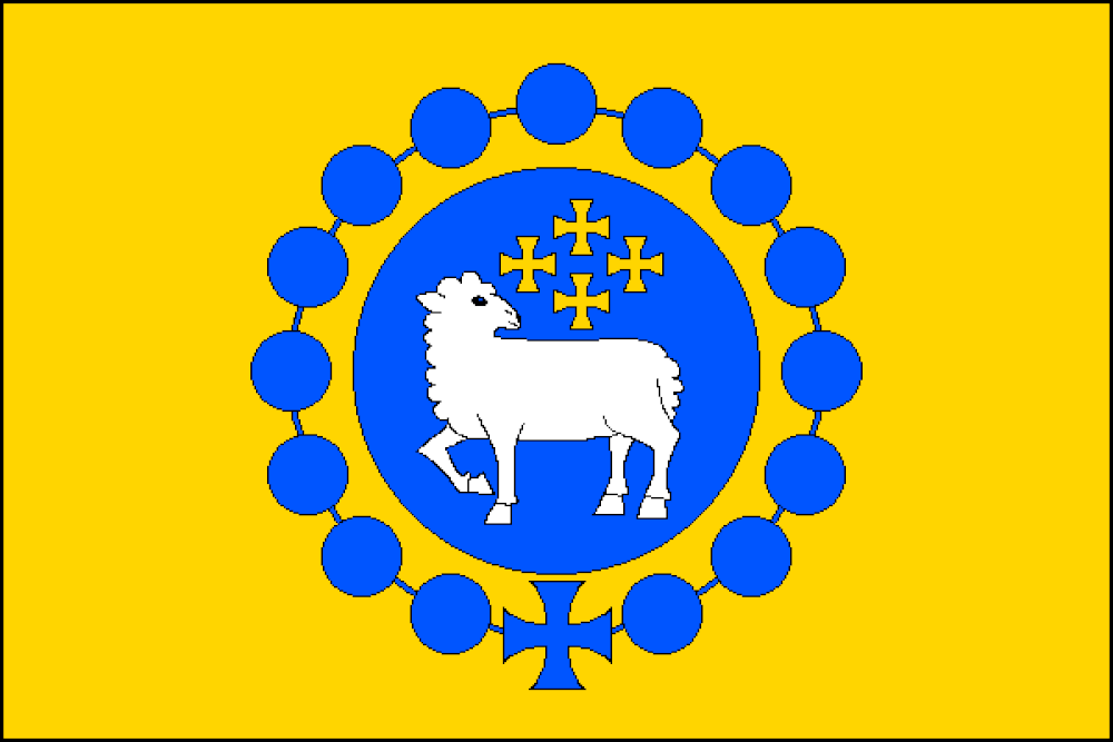
Flag Description: The flag consists of a yellow field with a blue circular disc in the center. The disc is surrounded by a rosary made of blue beads with a blue patty cross at the bottom. Inside the blue disc is a white walking lamb looking back, accompanied above by four yellow patty crosses arranged in a cross pattern (1, 2, 1).
Symbolism: The lamb and crosses reference local religious heritage, while the rosary made of bladdernut seeds (klokočí) serves as a canting symbol representing the name of the municipality.
Statistics
Area
3.67 km²
Population
254