Krásná Hora
Digital Passport
Nomenclature and Geography
Category: City / Municipality
Summary
About the place: Krásná Hora is a municipality and village in the Havlíčkův Brod District in the Vysočina Region of the Czech Republic. It is situated in the picturesque landscape of the Bohemian-Moravian Highlands and comprises several local hamlets.
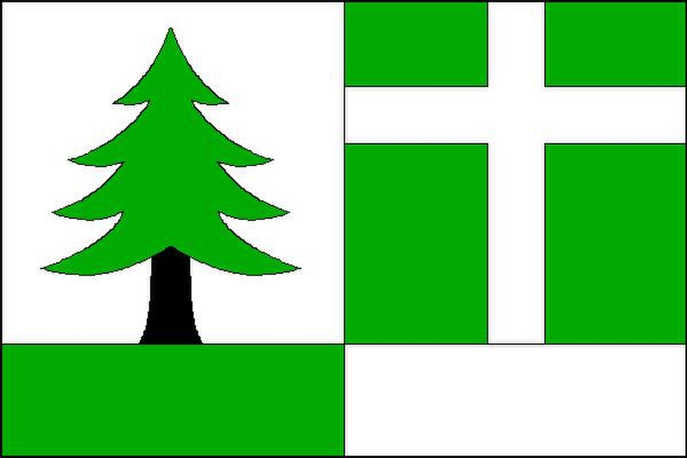
Flag Description: The sheet consists of two vertical stripes, the hoist one horizontally divided white over green in a 3:1 ratio, and the fly one horizontally divided green over white in a 3:1 ratio. A green coniferous tree with a black trunk grows into the upper white hoist field. In the upper green fly field is a white Latin cross with limbs one-eighth of the sheet's width wide.
Symbolism: The green coniferous tree symbolizes the surrounding deep forests and the name motif 'Hora' (Mountain), connected to the region's natural wealth. The white Latin cross refers to local spiritual traditions and sacred monuments. Green and white represent nature, purity, and the rural character of the municipality.
Statistics
Area
9.16 km²
Population
505