Langemark-Poelkapelle
Digital Passport
Nomenclature and Geography
Category: City / Municipality
Summary
About the place: Langemark-Poelkapelle is a municipality located in the Belgian province of West Flanders in the Flemish Region. The area is widely known for its rich history linked to heavy fighting during World War I.
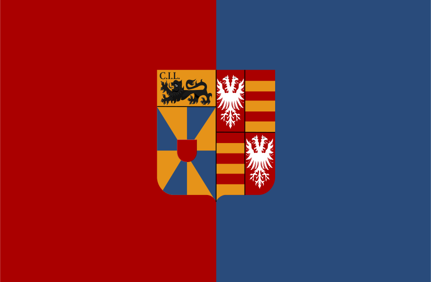
Flag Description: The flag consists of two vertical stripes, red on the hoist side and blue on the fly side. In the center of the flag is the municipal coat of arms. The shield is per pale; the dexter side (left from viewer's perspective) features a chief Or with a black passant lion accompanied by the letters 'C.I.L.', above a gyronny of eight Or and Azure with a gules inescutcheon. The sinister side (right from viewer's perspective) is quarterly, showing a silver eagle without a tail in the first and fourth red quarters, and horizontal stripes of Or and gules in the second and third quarters.
Symbolism: The red and blue colors of the flag field are derived from the traditional heraldic colors of the municipality. The coat of arms in the center combines the historical arms of the merged villages, with the lion and 'C.I.L.' lettering referring to historic lordships and the eagles and bars representing local noble families.
Statistics
Area
53.07 km²
Population
12,821