List auf Sylt
Digital Passport
Nomenclature and Geography
Category: City / Municipality
Summary
About the place: List auf Sylt is the northernmost municipality in Germany, located in the northern part of the island of Sylt near the border with Denmark. It is a popular seaside resort surrounded by coastal dunes, sandy beaches, and the Wadden Sea National Park.
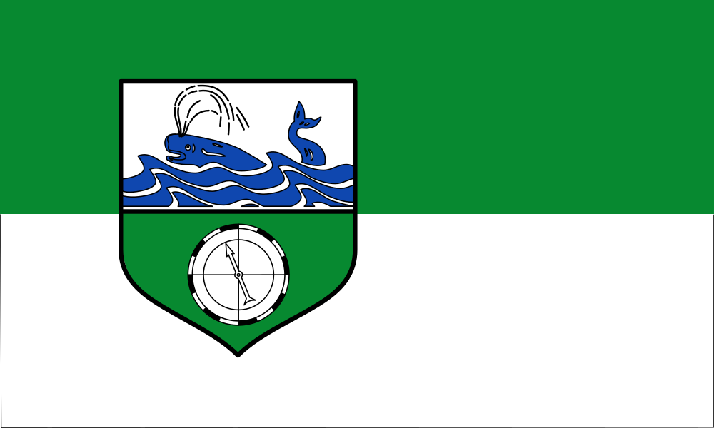
Flag Description: The flag of the municipality consists of two horizontal stripes – green on top and white on the bottom – with a 3:5 aspect ratio. The municipal coat of arms is placed in the hoist half. The shield is divided horizontally: the upper silver (white) field depicts a blue whale spouting water in blue waves, while the lower green field displays a silver and black compass rose.
Symbolism: The green and white colors represent the natural landscape of the island of Sylt, its dunes, and its sea coast. The whale in the upper field recalls the historical importance of whaling and seafaring for the local population, while the compass rose in the lower field symbolizes maritime navigation and the geographical location of Germany's northernmost point.
Statistics
Area
29.40 km²
Population
1,618