Mafra, Santa Catarina
Digital Passport
Nomenclature and Geography
Category: City / Municipality
Summary
About the place: Mafra is a municipality in southern Brazil, located on the northern border of the state of Santa Catarina along the Negro River. Together with its neighboring city Rio Negro in Paraná, it forms a prominent conurbation in the region.
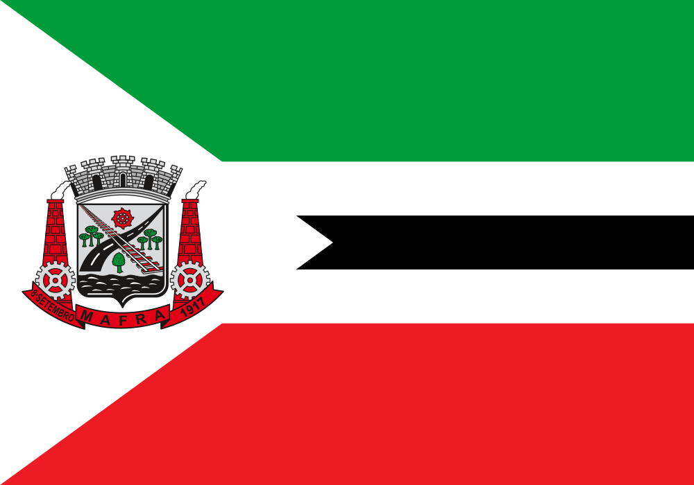
Flag Description: The flag consists of three horizontal stripes of green, white, and red, with a white triangle extending from the hoist side. In the middle of the central white stripe lies a black horizontal band with a swallowtail cut on the left, and the city coat of arms of Mafra is displayed within the white triangle.
Symbolism: The green, white, and red stripes reference the state colors of Santa Catarina. The coat of arms of Mafra depicts industrial development, transportation, and local natural resources along with the municipality's founding date of September 8, 1917.
Statistics
Area
1,404.21 km²
Population
55,286