Malá Morava
Digital Passport
Nomenclature and Geography
Category: City / Municipality
Summary
About the place: Malá Morava is a municipality and village in Šumperk District in the Olomouc Region of the Czech Republic, situated along the Morava River near the Králický Sněžník mountains.
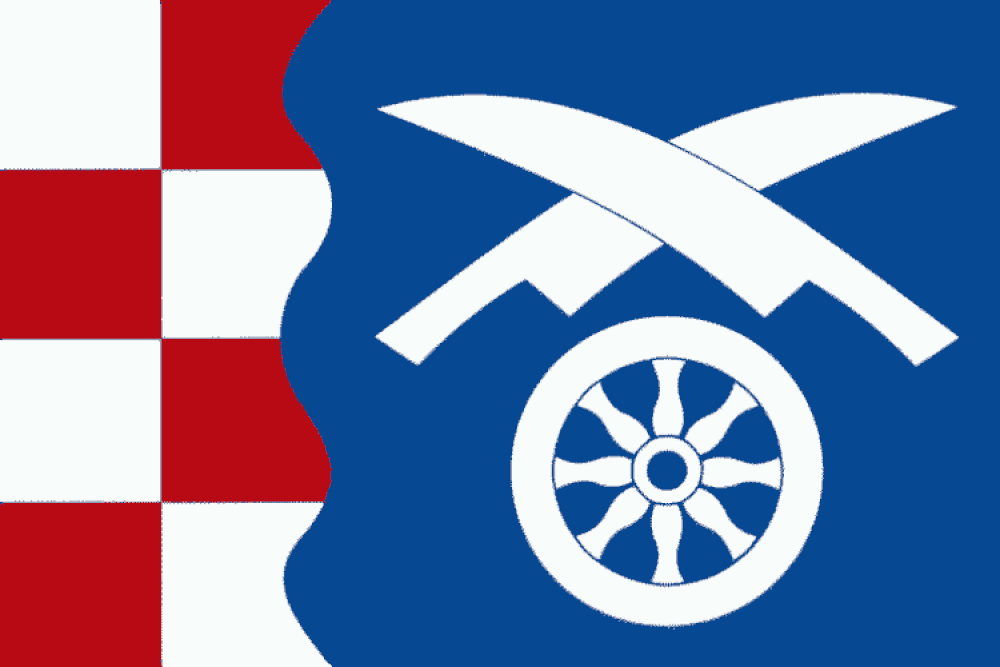
Flag Description: The flag field consists of two vertical stripes in a width ratio of 1:2. The hoist stripe is chequy white and red (in two columns and four rows), separated from the fly stripe by a wavy line with three crests and two troughs. The fly stripe is blue, featuring a white wagon wheel in the lower section, surmounted by two crossed white coulters with their points and cutting edges directed toward the top edge.
Symbolism: The white and red chequy pattern references the Moravian eagle and the historical connection to Moravia, while the wavy line and blue color symbolize the Morava River after which the municipality is named. The crossed coulters and the wagon wheel represent the traditional agricultural character of the settlements forming Malá Morava as well as historic local transport trades.
Statistics
Area
68.28 km²
Population
509