Mečichov
Digital Passport
Nomenclature and Geography
Category: City / Municipality
Summary
About the place: Mečichov is a village and municipality located in the Strakonice District in the South Bohemian Region of the Czech Republic. It lies near the border with the Plzeň Region, about 10 kilometers northwest of Blatná.
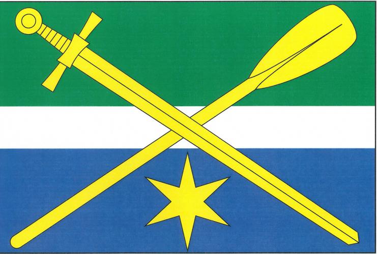
Flag Description: The flag consists of three horizontal stripes of green, white, and blue in a width ratio of 5:2:5. In the center of the field, a yellow sword pointing bendwise downwards toward the lower fly corner is crossed over an upright yellow oar placed bendwise sinister. A yellow six-pointed star is centered in the lower blue stripe.
Symbolism: The sword serves as a canting charge referencing the name of the village, Mečichov (derived from 'meč' - sword). The oar and the blue stripe symbolize the local ponds and long-standing tradition of fish farming in the region. The yellow six-pointed star stems from historical regional nobility coats of arms.
Statistics
Area
8.86 km²
Population
286