Professor Jamil
Digital Passport
Nomenclature and Geography
Category: City / Municipality
Summary
About the place: Professor Jamil is a municipality located in the central part of the state of Goiás, Brazil. It is situated south of the state capital, Goiânia, and is crossed by the major BR-153 highway.
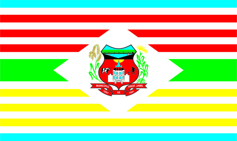
Flag Description: The flag consists of horizontal stripes in a complex multi-color layout: the upper portion features alternating red and white stripes bordered by a light blue stripe at the top edge, the center contains a broader green stripe flanked by white horizontal points, and the lower portion features alternating yellow and white stripes bordered by a light blue stripe at the bottom. In the center of the flag is a white rhomboid space containing the municipal coat of arms, which displays a shield with scenes of a bridge, a tower, cattle, and agricultural workers, flanked by crop stalks and a red ribbon reading 'MUNICÍPIO DE PROF. JAMIL 16/01 1991'.
Symbolism: The colors on the flag and elements within the coat of arms reflect the municipality's agricultural and economic heritage. Green, yellow, and red represent natural wealth, farming labor, and crop cultivation (such as rice and corn), while the central shield depicts local infrastructure, livestock farming, and the incorporation date of the municipality (January 16, 1991).
Statistics
Area
347.46 km²
Population
3,225